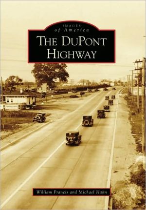
DuPont Highway, Delaware (Images of America Series)
The original DuPont Highway, found on maps as Route 13 between Dover and Wilmington and as Route 113 between Dover and the southern border with Maryland, was the nation's first divided highway when its expansion between Dover and Wilmington was completed in 1934. It had been officially dedicated 10 years earlier as the Coleman DuPont Road. Thomas Coleman du Pont, a descendant of E. I. du Pont and a two-time U.S. senator, had championed the road and paid nearly $4 million of his own money...
Search in google:
The original DuPont Highway, found on maps as Route 13 between Dover and Wilmington and as Route 113 between Dover and the southern border with Maryland, was the nation's first divided highway when its expansion between Dover and Wilmington was completed in 1934. It had been officially dedicated 10 years earlier as the Coleman DuPont Road. Thomas Coleman du Pont, a descendant of E. I. du Pont and a two-time U.S. senator, had championed the road and paid nearly $4 million of his own money toward its completion, even after turning the project over to the newly created Delaware State Highway Department. While other philanthropists started schools, libraries, parks, and hospitals, Coleman du Pont said, "I will build a monument a hundred miles high and lay it on the ground." He was close. The DuPont Highway measured 96.7 miles.


![The Complete National Geographic: Every Issue Since 1888 [With DVD] The Complete National Geographic: Every Issue Since 1888 [With DVD]](/application/data/covers/63/52/9781426296352.jpg)