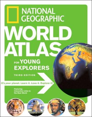
National Geographic World Atlas for Young Explorers, Third Edition
The latest edition of the award-winning National Geographic World Atlas for Young Explorers features all new photographs, maps, and graphics.\ And now, for the first time ever, the National Geographic World Atlas for Young Explorers goes interactive! The 3rd edition is chockfull of bright, bold icons that, thanks to a specially designed National Geographic web site, will allow kids to go beyond the printed page and experience firsthand the sights, sounds, and movements of the world's people,...
Search in google:
The latest edition of the award-winning National Geographic World Atlas for Young Explorers features all new photographs, maps, and graphics.And now, for the first time ever, the National Geographic World Atlas for Young Explorers goes interactive! The 3rd edition is chockfull of bright, bold icons that, thanks to a specially designed National Geographic web site, will allow kids to go beyond the printed page and experience firsthand the sights, sounds, and movements of the world's people, places, and animals. They'll watch brown bears fish for salmon in Alaska, listen to the latest singing sensation from Haiti, experience the power of a volcanic eruption, explore a rain forest, hang out at a local market in India, and much more.Every map is custom-designed for middle-grade students by the Society's world-renowned cartographers. Each map reflects the latest place-name and boundary changes. Every statistic in every fact box and every economic symbol on the regional maps reflects the very latest data available. All maps are shown in the context of surrounding areas to ensure that a complete picture of the world develops. Same-size physical and political maps make for easy comparisons and help youngsters understand how physical features influence patterns of human settlement and economic activity.Stunning images from space help link real-world images and give young readers a physical sense of the natural grandeur of our world. The National Geographic World Atlas for Young Explorers is a book that will expand the minds and stimulate the imaginations of kids everywhere.VOYAAGERANGE: Ages 11 to Adult. The unique feature of this atlas is the interactive linking of content to the National Geographic Web site (http://www.nationalgeographic.com/kids-world-atlas). Students can listen or watch videos about a topic from the Web site by browsing or linking the page number. An introduction gives instructions for use of the atlas and the site. Another suggested Web site provides a satellite view of the student's house and other features of interest. The physical world section includes environmental hotspots and natural disasters as well as physical features. The political world section provides separate maps for food, water, economics, literacy, religion, and population. Much of the atlas explores each continent in depth with exceptional physical and political maps as well as photos. Economic symbols accompany the political maps. In particular, the continent of Africa is divided into several sections with excellent detail to give the student an intimate look at this continent. The flags and statistics for 193 independent countries are listed at the back of the book. Unfortunately the oceans do not include the newly defined Southern Ocean (2000). Libraries can pass on this one in favor of an updated atlas showing the important Southern Ocean. Reviewer: Marilyn Brien April 2008 (Vol. 31, No. 1)
\ VOYAAGERANGE: Ages 11 to Adult. \ The unique feature of this atlas is the interactive linking of content to the National Geographic Web site (http://www.nationalgeographic.com/kids-world-atlas). Students can listen or watch videos about a topic from the Web site by browsing or linking the page number. An introduction gives instructions for use of the atlas and the site. Another suggested Web site provides a satellite view of the student's house and other features of interest. The physical world section includes environmental hotspots and natural disasters as well as physical features. The political world section provides separate maps for food, water, economics, literacy, religion, and population. Much of the atlas explores each continent in depth with exceptional physical and political maps as well as photos. Economic symbols accompany the political maps. In particular, the continent of Africa is divided into several sections with excellent detail to give the student an intimate look at this continent. The flags and statistics for 193 independent countries are listed at the back of the book. Unfortunately the oceans do not include the newly defined Southern Ocean (2000). Libraries can pass on this one in favor of an updated atlas showing the important Southern Ocean. Reviewer: Marilyn Brien\ April 2008 (Vol. 31, No. 1)\ \ \ \ \ \ Children's Literature\ - Carolyn Mott Ford\ A wealth of information, accompanied by topnotch photographs as expected from National Geographic, makes this book a wonderful addition to the school library. The facts are presented in such a way as to make this a book kids should enjoy browsing through on their own. Students are offered helpful hints for using the atlas and keys to the symbols used. The section titled "How to Read a Map" offers tips that students will find useful in general. The efforts to guide readers in looking up information and understanding that information are extensive. There are also many suggestions for finding information online. The maps are clear and detailed and the many sidebars will be of assistance to young students. A section of "Flags and Stats" appears in the back of the book along with a glossary, metric conversion tables, abbreviations, and "Geo Facts and Figures." Reviewer: Carolyn Mott Ford\ \ \ School Library JournalGr 4 Up -This update is ideal for tech-savvy students. Curious readers can use the related Web site to view photos and videos of animals in their natural habitats, hear audio clips, play games, print color maps, and send e-postcards. The lengthy introduction includes clear explanations of how to read the maps and use the Web site followed by information on the oceans, natural disasters, world population, religions, economies, food, water, and energy, with an emphasis on environmental concerns. Easy-to-read, full-color photos, maps, and graphs are included. The midsection of the book divides the world by continents. Each section opens with a crisp satellite image, and continues with an overview that includes a colorful photomontage of the continenta€™s animals, culture, and land, followed by physical, political, and thematic maps of regions and large countries. Sidebars provide area, population, major languages, religions, life expectancy, and literacy rates. Thought-provoking images include the tattooed face of a Maori warrior and a group of Afghan women in contrasting traditional and modern dress. The last section features flags and facts such as area and population for 193 countries and a section of records (the worlda€™s hottest place, longest river). The main revisions are the relocation of country flags and statistics to the back of the book rather than the main body; the maps are smaller; there are more photographs and text; the satellite images are clearer; and the Web links bring the information to life in an exciting, new way.-Barbara Auerbach, New York City Public Schools\ \ \


