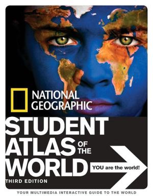
Student Atlas of the World
The third edition of the award-winning National Geographic Student Atlas of the World has everything for today’s globally-minded student: new photographs and graphics of our changing planet, maps that reflect modern borders, and fully updated essays and statistics.\ Specially designed for middle- and high-school students, this compact, fact-filled atlas will put the world at your fingertips. The third edition of this perennial favorite is chockfull of maps, charts, and graphs, photographs,...
Search in google:
The third edition of the award-winning National Geographic Student Atlas of the World has everything for today’s globally-minded student: new photographs and graphics of our changing planet, maps that reflect modern borders, and fully updated essays and statistics.Specially designed for middle- and high-school students, this compact, fact-filled atlas will put the world at your fingertips. The third edition of this perennial favorite is chockfull of maps, charts, and graphs, photographs, flags and facts—everything you need to help understand the world.You’ll begin by learning about maps and how to read them. Then you’ll explore the world’s physical and human systems, including Earth’s geologic history, natural vegetation, and world cultures. A stunning view from space introduces each continent, and full-page, full-color maps represent its physical and political make-up, its climate and precipitation, and its population and predominant economies. A vivid photo essay highlights an issue relevant to each continent, such as the European Union, or deforestation in the Amazon. Continuity of map sizes and scales encourages data comparison, which helps geography students to develop higher-level thinking skills.The National Geographic Student Atlas of the World is much more than maps. Weblink icons direct you to Internet sites to expand your knowledge and keep statistics up to date. The third edition of the award-winning National Geographic Student Atlas of the World is an invaluable resource and a must-have reference tool for libraries and homes everywhere.Children's LiteratureThis handy reference guide should interest readers of all ages. Aside from the many colorful maps, pictures, and interesting sidebars, the book contains different definitions of maps with illustrations, metric conversion tables, an artistic rendering of the alignment of the planets, and information on population density and wildlife. The only kind of map and information it does not contain are detailed street maps, but then, those are easily available on the internet. The accompanying text is easy enough for bright elementary school students but will be informative for older teens as well. This beautiful book gives the reader an expanded view of what the world is like and the many different climates, populations, and wildlife species that share the planet. This is handy for ready reference or simply reading to find out more about the subject of the earth we live on. Reviewer: Myrna Dee Marler
\ Children's LiteratureNational Geographic has produced an atlas that is packed with information about our planet. This very reader-friendly atlas will be a great resource for students. It begins with the big picture and briefly talks about how the earth fits into our solar system, how it rotates, and how the seasons and days work. Next, the different types of map projections are discussed, as well as how cartographers make them. It also gives a clear explanation of how to read maps, the symbols, the scales, and the different kinds of maps. The following pages contain maps about the different physical systems of the world. There are separate maps for geological features, historical features, land and water features, climates, climate controls, natural vegetation, environmental hot spots, political world, population, main cities, languages, world religions, predominant world economies, food production, fresh water supplies, energy and mineral resources, world conflicts, world refugees, globalization, cultural diffusion, and time zones. Lots of full-color photographs accompany the maps, including many showing population, giving a human face to the numbers. The second half of the book has a chapter devoted to each of the seven continents. Each continent chapter opens with a beautiful full-page spread based on a satellite image of the featured continent. There is a brief introduction and a section listing some geographical facts, including number of countries and population statistics. Over the next several pages of each chapter the same continent is shown in several different maps: an elevation map, a precipitation map, a population map, and a predominant economies map. The exception is the chapter on NorthAmerica which has additional political maps and elevation maps for each of the three main countries: Canada, United States, and Mexico. At the end of each continent chapter there is a double-page spread titled "Focus on" that shows photographs from that area of the world. Each continent has a different focus and adds one more way of looking at the world. For example, Asia's "Focus on" section is all about world heritage sites and includes a map of Asia pinpointing its important sites. The back matter contains a thematic index, a place name index, an extensive list of related web sites, and a glossary. Also included is a colorful display of flags and facts from the countries of the world. Under a picture of each country's flag, the reader can find the land area, the population, the capital city, and the main languages spoken in that country. The countries in this section are listed under the continent in which they appear. This makes it easy to match the flag to a particular country within this atlas. Even the endpapers contain a wealth of information: Metric conversion tables appear on one side and an interesting list of world facts on the other. Readers can look up the longest, highest, deepest, and other extremes. It even gives quick reference for some abbreviations. This book is part of National Geographic Society's series of atlases, which includes World Atlas for Young Explorers and The United States Atlas for Young Explorers, among others. Each of these has recently been revised and updated. 2005 (orig. 2001), National Geographic Society, Ages 7 to 14. \ —Sally J. K. Davies\ \


