Cartographia: Mapping Civilizations
CARTOGRAPHIA offers a stunning array of 200 of the most beautiful, important, and fascinating maps in existence, from the world's largest cartographic collection, at the Library of Congress. These maps show how our idea of the world has shifted and grown over time, and each map tells its own unique story about nations, politics, and ambitions. The chosen images, with their accompanying stories, introduce the reader to an exciting new way of "reading" maps as travelogues—-living history from...
Search in google:
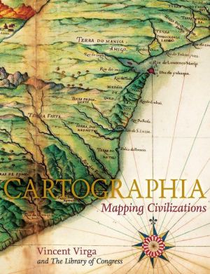
A richly illustrated exploration of maps and mapmaking, Cartographia celebrates the work of those who have mapped the world from the dawn of civilization to the present. In a text that journeys beyond the basic geographical facts, each map becomes a visual record of human endeavor – of diverse cultural, social, and economic landscapes – and each has a tale of wonder to tell. These maps, in their amazingly various forms, are models of time, diaries of intrigue, and illuminating works of art. Together they provide a unique vision of how the world and our understanding of it have changed over the past several centuries. More than 200 maps, selected from the Geography and Map Division of the Library of Congress – the largest cartographic collection in the world – are reproduced in this sumptuous volume. Some of the rarest and most spectacular maps ever made are featured here, including: The Waldseemüller Map of the World from 1507, the first to include the designation "America" Pages from Ortelius's Theatrum Orbis Terrarum of 1570, considered the first modern atlas Rare maps from Africa, Asia, and Oceania that challenge traditional Western perspectives William Faulkner's hand-drawn 1936 map of the fictional Yoknapatawpha County, Mississippi A 2001 map of the human genome With their accompanying stories, the vivid color plates in Cartographia introduce the reader to an exciting new way of reading maps as travelogues – as living histories from the earliest imaginings about planet Earth to our current attempts at charting cyberspace, the latest of our "last frontiers." The New York Times - Felipe Fernandez-Armesto Clear design, a manageable format, efficient printing and a diverse, dazzling selection of material make Cartographia: Mapping Civilizations a good Christmas stocking-buster or a greedy holiday indulgence. The maps are well chosen for study, ornament and delight.
\ From Barnes & NobleA visual feast for collectors, historians, and art lovers, these exquisite full-color maps from the cartographic collection of the Library of Congress offer dramatic proof of changes -- both subtle and startling -- in our view of the world over the course of four centuries. The stunning, oversized volume includes a spectacular array of images, from rare antique nautical charts and the first "modern" atlas to a replication of the human genome map, an astonishing scientific document providing the genetic blueprint for a human being,\ \ \ \ \ Felipe Fernandez-ArmestoClear design, a manageable format, efficient printing and a diverse, dazzling selection of material make Cartographia: Mapping Civilizations a good Christmas stocking-buster or a greedy holiday indulgence. The maps are well chosen for study, ornament and delight.\ —The New York Times\ \ \ Publishers WeeklyDrawing on the Library of Congress's 4.8 million maps and 60,000 atlases, this is an overview of cartography in different times and cultures. Veteran picture editor Virga upends our notion of maps as two-dimensional representations of physical spaces by presenting depictions of imaginative or spiritual territory: a 17th-century "map of the soul" has five entry points, each corresponding to one of the five senses. And while we're accustomed to maps being oriented north, Islamic and some other cartographers oriented their maps south, as in an eye-opening 1996 "Upside Down World Map" made in Australia that shows the "down under" continent approximately where we usually see Greenland. Virga provides historical, sociological and anthropological background to each map. Captions for the plates are so small as to be almost unreadable, making it difficult to follow Virga's interpretations of the maps. Still, this is one of those rare coffee-table books that deserves to be read, that repeatedly delights the eye while informing the mind about the rich variety of humans' attempts to orient themselves in the world. 201 color illus. (Oct.)\ Copyright 2007 Reed Business Information\ \ \ \ \ Library JournalUnlike other recent publications of similar scope, treatment, and content-including Walker's Map Book(2006), Sterling's 100 Maps(2005), and Firefly's The World Through Maps(2003)-this selection of antique and modern maps, beautifully reproduced in full color, highlights the incomparable holdings of one collection: the Geography and Map Division of the Library of Congress. Only a few examples are drawn from other sources. Virga, a graphics editor and novelist, uses more than 200 maps to illustrate a multicultural historical survey of cartography presented chronologically by topic: "The Mediterranean World," "The Three-Part World: Asia, Africa, Europe," "The Fourth Part: The Americas," "The Fifth Part: Oceania and Antarctica," and an epilog: "The Unseen Cultural World." The accompanying text is intended for the general reader. A "Cartobibliography" offers plate-by-plate access to provenance and bibliographical citations.\ —Edward K. Werner\ \ \


