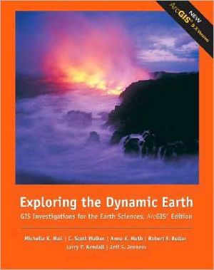
Exploring the Dynamic Earth: GIS Investigations for the Earth Sciences, ArcGIS Edition
Explore, analyze, and elaborate on information you extract using ArcGIS software with EXPLORING THE DYNAMIC EARTH: GIS INVESTIGATIONS FOR THE EARTH SCIENCES. This interactive investigation lets you tap the power of the ArcGIS software to explore, manipulate, and analyze large data sets. This guide emphasizes the visualization, analysis, and multimedia integration capabilities inherent to GIS. The GIS information has been preprocessed into maps and legends, and some procedures have been...
Search in google:
Explore, analyze, and elaborate on information you extract using ArcGIS? software with EXPLORING THE DYNAMIC EARTH: GIS INVESTIGATIONS FOR THE EARTH SCIENCES. This interactive investigation lets you tap the power of the ArcGIS? software to explore, manipulate, and analyze large data sets. This guide emphasizes the visualization, analysis, and multimedia integration capabilities inherent to GIS. The GIS information has been preprocessed into maps and legends, and some procedures have been automated so you can focus on the science content. Booknews A hands-on guide for computer novices, this book/CD-ROM package shows how to use geographic information systems (GIS) software to explore, manipulate, and analyze large data sets. Based on observations derived from real research programs, exercises begin with global issues, then progress to regional and local issues, highlighting connections between science and society and relating global phenomena to daily life. Step-by-step instructions guide readers through launching the GIS application, finding files, and querying databases. The companion CD-ROM contains ArcView GIS software and data sets for exercises. The authors are affiliated with the University of Arizona. Annotation c. Book News, Inc., Portland, OR (booknews.com)
Unit 1: SEARCHING FOR EVIDENCE. A Changing Earth. Investigating Earth's clues. Discovering plate tectonics. Analyzing plate boundaries. Unit 2: EXPLORING PLATE TECTONICS. Testing plate tectonics. Investigating seafloor age. Determining seafloor age. Investigating plate motion. Unit 3: EARTHQUAKE HAZARDS. The Great Lisbon Earthquake. Deadly earthquakes. Seismic hazards. Seismic risk and society. Unit 4: VOLCANO HAZARDS. The tragedy of Mont Pelée. Deadly volcanoes. Volcanic hazards. Volcanoes and climate. Unit 5: TSUNAMI HAZARDS. Scotch Cap Light Station. Deadly tsunamis. Analysis of a tsunami. Tsunami warning. 2004 Indonesian Tsunami.
\ A hands-on guide for computer novices, this book/CD-ROM package shows how to use geographic information systems (GIS) software to explore, manipulate, and analyze large data sets. Based on observations derived from real research programs, exercises begin with global issues, then progress to regional and local issues, highlighting connections between science and society and relating global phenomena to daily life. Step-by-step instructions guide readers through launching the GIS application, finding files, and querying databases. The companion CD-ROM contains ArcView GIS software and data sets for exercises. The authors are affiliated with the University of Arizona. Annotation c. Book News, Inc., Portland, OR (booknews.com)\ \
