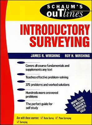
Schaum's Outline of Introductory Surveying
With 375 problems fully solved step by step, and clear, well-illustrated coverage of the practices and applications of surveying, this powerful study guide can help you master your course with less study time. Perfect for independent study, it gives you full coverage of the entire subject, from trigonometry for surveyors through drawing maps. With Schaum's, you know you're getting a quality product, and this study guide for beginning courses in surveying is the best there is.\ \ \...
Search in google:
Master introductory surveying with Schaum's—the high-performance study guide. It will help you cut study time, hone problem-solving skills, and achieve your personal best on exams!Students love Schaum's Outlines because they produce results. Each year, hundreds of thousands of students improve their test scores and final grades with these indispensable study guides. Get the edge on your classmates. Use Schaum's!If you don't have a lot of time but want to excel in class, this book helps you: Brush up before tests Find answers fast Study quickly and more effectively Get the big picture without spending hours poring over lengthy textbooksSchaum's Outlines give you the information your teachers expect you to know in a handy and succinct format—without overwhelming you with unnecessary details. You get a complete overview of the subject. Plus, you get plenty of practice exercises to test your skill. Compatible with any classroom text, Schaum's let you study at your own pace and remind you of all the important facts you need to remember—fast! And Schaum's are so complete, they're perfect for preparing for graduate or professional exams.Inside, you will find: 375 problems, with step-by-step solutions Hundreds of additional practice problems, with answers supplied Clear explanations of surveying applications and practices Understandable coverage of the mathematics and measurements used in surveyingIf you want top grades and a thorough understanding of introductory surveying, this powerful study tool is the best tutor you can have!
Chapter 1Trigonometry for Surveyors11.1Trigonometry11.2Angles and Their Measurement11.3Expressing the Fractional Part of a Degree in Minutes and Seconds11.4Expressing an Arc in Radians21.5Angle Conversions31.6Operations with Angles Expressed in Degrees, Minutes, and Seconds41.7Areas of Triangles61.8Interior Angles of Triangle71.9Exterior Angles of a Triangle81.10Pythagorean Theorem81.11Standard Position for an Angle81.12Trigonometric Ratios91.13Trigonometric Functions on a Calculator10Chapter 2Field Notes252.1Reason for Field Notes252.2Requirements for Good Notes252.3Types of Field Books262.4Kinds of Notes262.5Arrangement of Field Notes262.6Suggestions on Recording Notes282.7Proper Methods302.8Significant Figures342.9Rounding Off Numbers35Chapter 3Horizontal Distances423.1Methods of Measurement423.2Pacing423.3Odometer Readings433.4Horizontal Sights by Stadia433.5Electronic Distance Measurements453.6Precision of Various Measuring Methods453.7Taping463.8Slope Taping Procedure473.9Corrections503.10Slope Computations513.11Stationing523.12Notekeeping543.13Sources of Error543.14Common Mistakes55Chapter 4Transits614.1General Information614.2Differences between Transits and Theodolites634.3Relationships of Angles and Distances634.4Telescopic Sight644.5Line of Sight654.6Verniers654.7Transit Geometry674.8The Compass694.9Magnetic Declination694.10Variations in Magnetic Declination694.11Local Attraction704.12Sources of Error in Compass Work704.13Mistakes in Compass Work714.14Determining an Accurate Compass Bearing714.15Measuring a Horizontal Angle724.16Field Records724.17Recording the Field Notes744.18Sources of Error in Transit Work74Chapter 5Leveling845.1Introduction845.2Types of Leveling845.3Leveling Equipment845.4Orders of Accuracy885.5Level Bench Marks885.6Differential Leveling895.7Sight Distances905.8Balancing Foresights and Backsights915.9Curvature and Refraction925.10Adjusting the Level925.11Field Procedure945.12Recording955.13Profile Leveling975.14Trigonometric Leveling99Chapter 6Angle Measurement1216.1General Information1216.2Direction1216.3Measuring Angles by Repetition1216.4Prolonging a Line Past an Obstacle by Angles1256.5Kinds of Horizontal Angles1266.6Closing the Horizon1276.7Azimuth1276.8Bearings1296.9Comparison of Bearings and Azimuths1296.10Bearing Calculations1306.11Computing Azimuths1316.12Factors Affecting Angle Observations1316.13Common Mistakes133Chapter 7Traverses1437.1Definitions1437.2Use of Traverses1437.3Traverse Field Work1437.4Traverse Computations1457.5Working a Connecting Traverse154Chapter 8Topographic Surveys1738.1Definition of Topographic Surveying1738.2Scales1738.3Topographic Representation1738.4Contour Lines1748.5Field Methods1778.6Cross-Section Method1778.7Plotting the Points1798.8Interpolating1798.9Other Methods of Obtaining Topography1808.10Coordinate Square Method1808.11Geometric Location of Contour Points1828.12Sources of Error in Topographic Surveys184Chapter 9Construction Surveys1949.1Introduction1949.2Methods1949.3Transfer from Stakes to the Improvement1949.4Baseline and Offset Control1959.5Angle-and-Distance Method1969.6Complex Plans: Coordinate Method1999.7Establishing Line in the Field: Marking Position2009.8Establishing Grade: Marking Elevations2019.9Methods of Giving Grade201Chapter 10Slope Staking21910.1Definition21910.2Method21910.3Information Required22010.4Summing up Slope Staking Procedures22610.5Field Notes226Chapter 11Earthwork23911.1Importance of Earthwork23911.2Cross Sections23911.3Areas23911.4Counting-the-Squares Method24011.5Geometric Method24111.6Stripper Method24211.7Double-Meridian-Distance Method24211.8Area by Coordinates24511.9Volumes24611.10Volume by Average End Areas24611.11Volume by End-Areas Table24711.12Volume by Prismoidal Formula250Chapter 12Horizontal Curves26712.1Introduction26712.2Types of Horizontal Curves26712.3Elements of a Simple Curve26712.4Simple Curve Formulas (Arc and Chord Definitions)27012.5Solution of a Simple Curve27112.6Staking Out a Simple Horizontal Curve27212.7The Compound Curve277Chapter 13Vertical Curves30013.1Why Vertical Curves Are Used30013.2Definitions30013.3Computing Vertical Curves: The Stage Method30113.4Computing Vertical Curves: The Direct Method30413.5Vertical Curve in Sag306Chapter 14Drawing Maps33414.1Introduction33414.2Types of Maps33414.3Horizontal Ties33414.4Vertical Ties33714.5Map Scale33914.6Map Drafting33914.7Plotting the Control34014.8Plotting Angles34014.9Topographic Symbols34214.10Placing the Map on a Sheet34214.11Meridian Arrow34214.12Title34414.13Paper34414.14Sources of Error in Mapping345Index357


