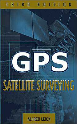
GPS Satellite Surveying
The revised and updated authoritative volume on GPS use in surveying\ Comprehensive and thorough in its coverage, GPS Satellite Surveying, Third Edition is the updated edition of Alfred Leick’s classic introduction to the field. Written to help specialists get the most out of GPS surveying techniques and the resulting measurements, this standard industry reference provides the latest fundamental and cutting-edge material for working with GPS today.\ A unique volume in the field, this Third...
Search in google:
The revised and updated authoritative volume on GPS use in surveying Comprehensive and thorough in its coverage, GPS Satellite Surveying, Third Edition is the updated edition of Alfred Leick’s classic introduction to the field. Written to help specialists get the most out of GPS surveying techniques and the resulting measurements, this standard industry reference provides the latest fundamental and cutting-edge material for working with GPS today. A unique volume in the field, this Third Edition offers an unrivaled presentation of procedures that apply to the Russian GLONASS, the forthcoming European GALILEO, and U.S. GPS satellite systems. New coverage addresses emerging precise-point positioning technology, as well as the most current information on: Geodetic reference systems GPS modernization Least-squares adjustments Pseudoranges and carrier phases The troposphere and ionosphere The LAMBDA technique The ellipsoidal and conformal mapping models GPS Satellite Surveying, Third Edition is a dependable, up-to-date reference for surveyors, civil engineers, transportation engineers, geologists, geographers, technicians, and students. Booknews Using a network of orbiting satellites, the Global Positioning System (GPS) now makes it possible for ground-based technicians with hand- held monitors to determine their positions with a degree of precision previously unachievable by traditional surveying methods. This revised and updated comprehensive text--an abbreviated syopsis of courses on GPS and satellite geodesy, adjustment computations, geodetic models, and integrated geodesy as taught at the U. of Maine--is designed to help surveyors, engineers, and other land information specialists gain full use of GPS surveying techniques and an understanding of the resulting measurements. Annotation c. Book News, Inc., Portland, OR (booknews.com)
PrefaceAcknowledgmentsAbbreviationsNotation1Introduction12Geodetic Reference Systems113Satellite Systems534Least-Squares Adjustments925Pseudorange and Carrier Phase Observables1706Troposphere and Ionosphere1887Processing Pseudoranges and Carrier Phases2288Network Adjustments3019Two-Dimensional Geodetic Models321App. AGeneral Background340App. BThe Ellipsoid367App. CConformal Mapping387References413Author Index425Subject Index431
\ From the Publisher"...third edition...reinforces its status as a standard industry reference...updated to cover emerging precise-point position technology..." (GEO Connexion, June 2004)\ \ \ \ \ \ BooknewsUsing a network of orbiting satellites, the Global Positioning System (GPS) now makes it possible for ground-based technicians with hand- held monitors to determine their positions with a degree of precision previously unachievable by traditional surveying methods. This revised and updated comprehensive text--an abbreviated syopsis of courses on GPS and satellite geodesy, adjustment computations, geodetic models, and integrated geodesy as taught at the U. of Maine--is designed to help surveyors, engineers, and other land information specialists gain full use of GPS surveying techniques and an understanding of the resulting measurements. Annotation c. Book News, Inc., Portland, OR (booknews.com)\ \
